
OK, I am not curing cancer, but with my skills in Cloud Applications and Geo Information Systems, I was hoping at least I can help someone who will. And so I did! By putting together a cloud-native application in few weekends, merging 3D GIS, Geospatial Analysis and Online Payments, that would help my sister, the doctor, travel the world, relax and thus get even better at her job :)
My sister is a medical resident in The Hague and at the same time is also defending here PhD in only a few weeks. Two very stressful jobs. So, to help her not get a burn-out and keep being a benefit to the medical world after getting her PhD, we thought it would be great idea to send her to relax on a great world trip. And how great would it be if we could also use the huge group of invitees to her PhD defense to inspire her with their own suggestions and donations for the travel?
The Challenge – collect and correlate financial data based on GPS location
So, this meant more than 150 invitees, all submitting their own destination suggestions and different donation amounts. But she has only 2 weeks to make the trip, can visit a limited number of places and has a finite budget. So how could I help her make the best selection of destinations for her trip without getting a headache? This was my challenge…
Basically, I needed a way to collect a bunch of geographic location related data (GPS coordinates, country, city etc. and the euro amount of the donation) and run analyses on it - correlating the amounts of the donations based on their corresponding GPS coordinates. Pen and paper were quickly dismissed as a solution, but as an IT engineer and with a background in Geographic Information Systems (GIS), I had to be able to come up with a way to do this.
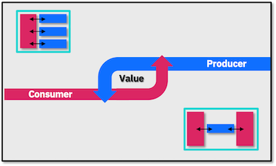
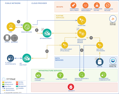
The Building Blocks – how to start small and leverage a platform to expand
It was initially going to be a hobby project, but as a software geek, I could not accept an amateur-level execution even under a time pressure. So, I started with ideas for an app with three important requirements:
1. put something together quickly, but at the same time in a way that could be easily scaled up later. It had to be live in a few weeks, but in case it turns out to be a huge success, I want to be able to scale it up and plug-in additional components for more functionality without too much effort or completely rewriting the application
2. make it visually appealing without writing the UI from scratch, both for the contributors as well as for the traveler to be. In the end, the more people use the platform the better campaign it will be
3. leverage open standards as much as possible which would save me time. Any integration can then be quick and easy, and I could use ready-to-go opensource software
….oh and one more thing – I wanted to be able to monitor the performance and user experience of the application, real-time.
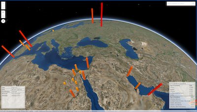
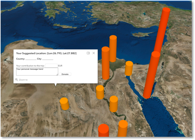
The End-Product – travel advice using location-based financial analysis
So, only 2 weekends (but many Reb Bulls) further I ended up with this:

Follow the link below and you are more than welcome to contribute as well J
If you want to know the details on the different components I used, look out for Part-II coming out in a few days!